LabelMe v6.0.0 is released (satellite/GeoTIFF support).→ see all updates
LabelMe logoLabelMe
How it worksKey featuresExamplesPricingDocumentationBlog
日本語中文
Sign in
How it worksKey featuresExamplesPricingDocumentationBlog
  • Installation
  • Install LabelMe as App
  • Install LabelMe using Terminal
  • Install LabelMe using Terminal (old way)
  • Install LabelMe Toolkit
  • All released versions
  • Troubleshoot
  • Toolkit Docs
  • ai-annotate-rectangles
  • ai-rectangle-to-mask
  • export-to-voc
  • export-to-yolo
  • extract-image
  • import-from-yolo
  • json-to-mask
  • json-to-masks
  • json-to-visualization
  • list-labels
  • print-stats
  • rename-labels
  • resize-image
  • Starter Guide
  • 1. Annotate image with LabelMe
  • 2. Open and edit annotated file
  • 3. Load annotated file with Python
  • 4. Export annotated file to PNG
  • 5. Load exported files with Python
  • Dataset Guide
  • 1. Download real dataset
  • 2. Verify dataset visually
  • 3. Verify dataset statistically
  • 4. Additional data collection
  • 5. Export dataset
  • Bonus: PyTorch dataset class

Dataset Guide

Dataset guide workflow overview
  • 1. Download real dataset
  • Download an example dataset
  • Unzip the dataset
  • 2. Verify dataset visually
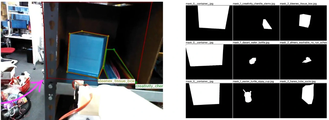
  • 1. Visualize the JSON files
  • 3. Verify dataset statistically
  • 1. Show stats
  • 4. Additional data collection
  • 1. Compatibility
  • 5. Export dataset
  • Convert dataset to a common format (masks)
  • Bonus: PyTorch dataset class
  • Write PyTorch dataset class